Jurisdictions and Municipalities
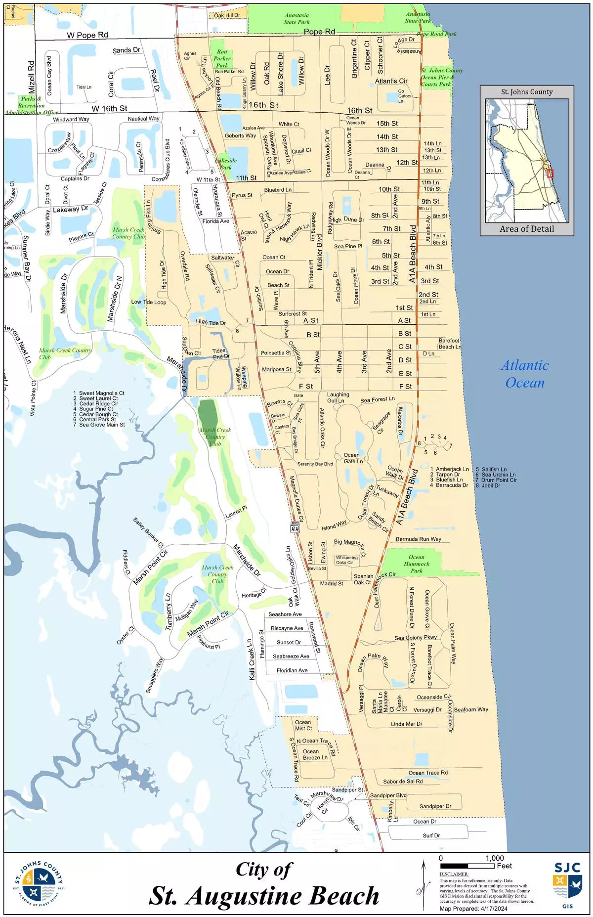
Our city is around 2-3 miles long, spanning from: Pope rd. in the North to Sand Piper Plaza at the South and about 1 mile wide from A1A South in the West and into the Dunes on the beach in the East.
On the West, side of A1A South we have: Seagrove subdivision, Watson Realty office, State Farm offices, Trulieve dispensary (former Zaharia's restaurant), Americas Best Value Inn motel, Walgreens and Ocean Trace subdivision.
Surrounding our city, is St. Johns County their jurisdiction starts at our borders and expands North, West and South.
To the North North-West, is also the city of St. Augustine.
Below is the City of St. Augustine Beach's jurisdictional map.
See also:
- "St. Johns County interactive Imap" - This shows the entirety of St. Johns County, St. Augustine, and St. Augustine Beach. This map is linked to the Property Appraiser and provides the most information available.
- "St Johns County Property appraiser" - This provides specific property information.
- "St. Johns County GIS map gallery" - This is the St. Johns County searchable GIS map data base.
Additional GIS map:
- "ASCE Hazard Tool" - the quick, reliable, and free way to look up key design parameters specified in ASCE standards. (American Society of Civil Engineers)
Surrounding Jurisdictions:
|
75 King Street Lobby B, 4th Floor |
500 San Sebastion View, St. Augustine FL 32084
|